Microsoft
PL-300 · Question #89
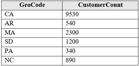
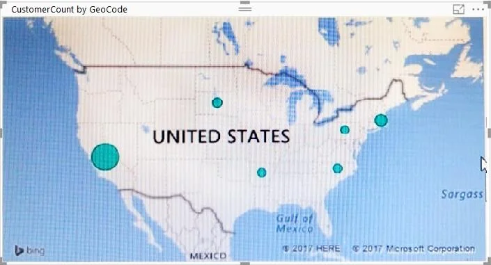
You have the following table named Location. The GeoCode column represents the country where each customer is located. You create a map visualization as shown in the exhibit. (Click the Exhibit tab.)
Sign in or unlock PL-300 to reveal the answer and full explanation for question #89. The question stem and answer options stay visible for context.
Submitted by yuriko_h· Apr 18, 2026Visualize and analyze the data
Question
You have the following table named Location. The GeoCode column represents the country where each customer is located. You create a map visualization as shown in the exhibit. (Click the Exhibit tab.) You need to ensure that the map displays the country locations. What should you do?
Exhibits
Options
- AReplace the values in the GeoCode column with postal codes or zip codes.
- BChange the name of the GeoCode column to Country.
- CChange the name of the Location table to Country.
- DChange the Default Summarization of the GeoCode column.
- EAdd a Geoportal column to the Location table.
- FChange the Data Type of the GeoCode column.
Unlock PL-300 to see the answer
You've previewed enough free PL-300 questions. Unlock PL-300 for full answers, explanations, the timed quiz mode, progress tracking, and the master PDF. Question stem and options stay visible so you can still see what's on the exam.
Topics
#Map visualization#Geographical data#Data categorization#Column renaming